Geological Links
National Organisations
British Geological Survey. The BGS is a public sector organisation that is responsible for advising the UK government on all aspects of geoscience as well as providing impartial geological advice to industry, academia and the public.
The Geologists Association is for all geologists and earth scientists, both professional and amateur. Many local amateur geological societies are affiliated to the GA.
The Geological Society. The oldest geological society in the world. The Geological Society of London is the recognised UK professional body for geoscientists and awards qualification of Chartered Geologist. There is a West Midlands Regional Branch of the GS.
The Geology Trusts is a multi-regional umbrella organisation established to support county-based geoconservation groups across England.
GeoconservationUK exists to promote local “Geo” sites for education and public benefit and works towards a British Isles perspective, focusing on the common purposes and issues of local interest to Groups. GeoConservationUK has a membership of over 50 Local Geoconservation Groups, lately known as RIGS Groups (Regionally Important Geological and geomorphological Sites) across the British Isles. In England they are often called Local Geological Sites.
The UK Onshore Geophysical Library is a charitable body providing a substantial open-access resource of commercial data on the deep geology beneath our feet – promoting education, research and development. They also fund the Strata-Smith site, celebrating the life and works of William Smith, again with access to a wide range of interactive resources and maps.
Local Organisations (that you can join)
Black Country Geological Society. Based in Dudley, West Midlands. The society was formed in 1975 and has, since then, maintained a strong active membership. Their members come from all backgrounds and include interested amateurs, professional geologists, teachers, and students of all ages. They hold regular indoor meetings with invited lecturers, field trips to sites of geologic interest, and engage in geoconservation work at local sites.
Gloucestershire Geology Trust is a registered charity and a founder member of The Geology Trusts. The Trust was set up in 1992, with the aim of surveying and recording Regionally Important Geological Sites (RIGS). GGT also carry out conservation work on important geological sites; they hold the Geological Records Centre for the county; produce a variety of guides and publications; run a highly successful Rock & Fossil Roadshow programme and offer a variety of events throughout the year. GGT have embarked on a new and exciting project called ‘Geowardens’, which aims to raise awareness of the fantastic geology and landscape in the area, and to develop a team of local volunteers to help conserve and enhance the rock exposures along the Huntley, Longhope & Hobb’s Ridge Geology & Landscape Trail.
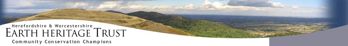
Herefordshire & Worcestershire Earth Heritage Trust is a charity that aims to record, protect and promote geology and landscape, and to raise awareness of this Earth Heritage by engaging the public in educational programmes. The Trust is also involved in promoting healthy living through walking with our ‘Explore’ self guided trails, Geopark Way long distance trail and its associated free trail leaflets.
Mid Wales Geology Club are a friendly get-together of enthusiasts who have an interest in various aspects of geology. They range from complete novices to experts and meet regularly in Newtown.
Open University Geological Society, West Midlands Branch. The Society was formed in 1972 by OU geology students to support their studies with more practical experience through field trips, lectures and other events. The Branch covers Warwickshire, the West Midlands, Staffordshire, Shropshire and Worcestershire.
Shropshire Geological Society aims to advance the education of the public and to promote research in geology and allied sciences, more specifically in Shropshire and adjacent areas, in particular but not exclusively by: (a) organising lectures, discussions, field excursions, exhibits and displays, and (b) promoting the recording and conservation of sites of geological interest.
Teme Valley Geological Society. Martley as a centre of extraordinary geology.
Warwickshire Geological Conservation Group was established in 1990 by few enthusiasts who wanted to raise awareness of and conserve the many rock exposures dotted around the county. The membership has since grown and includes many enthusiastic amateurs, students and teachers as well as some professional geologists.
Woolhope Naturalists Fieldclub. The origins of the Woolhope Club reach back to the founders’ interest and research in the geology of the Woolhope Dome and its Silurian stratigraphy, dating from the mid-19th century. Amongst other subjects, geology has featured in its activities ever since. However, in November 2002 a specialist Geology Section was formed so that this field of interest could be pursued more actively.
The University of the Third Age
Leominster and District U3A geology
Malvern U3A geology
North Cotswolds U3a – Rocks, Fossils and Stars
Ross on Wye U3A geology
Apps
British Geological Survey free smartphone apps:
iGeology, for iPhone/iPad, Android and Kindle Fire, gives you an interactive geological map of the UK. Download iGeology from iTunes or Google Play
iGeology 3D, for Android, ‘paints’ a geological map on the ground around you. It can be used alone or as a companion product to iGeology. Download iGeology 3D from Google Play
mySoil, for iPhone/iPad and Android devices, gives you an interactive map of the soils of Britain. Download mySoil from iTunes or Google Play
Geopark Way apps:
Each of the 17 sections of the Geopark Way now has a dedicated app available for smart-phones and tablets. Each app has a map of the relevant section overlain on an interactive geology map. Using GPS you get your position and a feed of data about the geology and other information as you walk. Other information’ includes photos of the walk with directional guidance, 3D cross-sections, and interpretations of past environments. They can be downloaded from iTunes or Google Play.
London Pavement Geology mobile app is new for Autumn 2016 for both iPhone and Android devices (see Urban Geology below).
Places of Interest
Abberley and Malvern Hills Geopark. The Geopark covers 1250 square kilometres and takes in parts of the four counties of Gloucestershire, Herefordshire, Shropshire and Worcestershire. You will find outstanding geology that spans 700 million years of our Earth’s history. This, coupled with dramatic landscapes and a wealth of ecological, historical, and cultural gems, makes the Abberley and Malvern Hills a truly unique Geopark.
The Malvern Hills GeoCentre featuring Cafe H2O is the official visitor information centre for the Geopark Way, situated on the western slopes of the Hills, providing information about the Abberley and Malvern Hills Geopark, the Malvern Hills Area of Outstanding Natural Beauty, and the Malverns.
The Lapworth Museum of Geology at Birmingham University dates back to 1880, and is one of the oldest specialist geological museums in the UK. It is open to the public and free. The Lapworth Lecture Series is a regular series of free public lectures.
The Oxford University Museum of Natural History houses the University’s scientific collections of zoological, entomological and geological specimens. The Museum itself is a Grade 1 listed building, renowned for its spectacular neo-Gothic architecture. Among its most famous features are the Oxfordshire dinosaurs, the dodo, and the swifts in the tower.
Urban Geology is a website about the geology of the built environment. This includes the building stones and other materials used in town and cities as well as the tantalising glimpses of the pre-urban landscape and underlying bedrock. Cities are shunned by many geologists and considered as somewhere to escape, and yet many geologists live and work in cities, whether in universities or in the stone, mineral and hydrocarbon extraction industries, and there is much to learn from building stones. Importantly they are an untapped and enormous resource for teaching at all levels. This is Ruth Siddall’s website with over 3 dozen (mostly London) trails. See also London Pavement Geology where you can see maps with the sites marked and download apps.